Real adventure is in the path followed and not necessarily the destination.
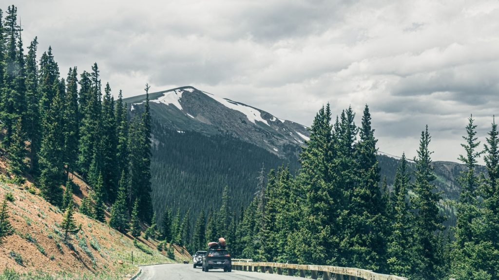
We live in a big and beautiful world that encompasses many overland routes and off-road trails waiting to be explored on our quest for adventure.
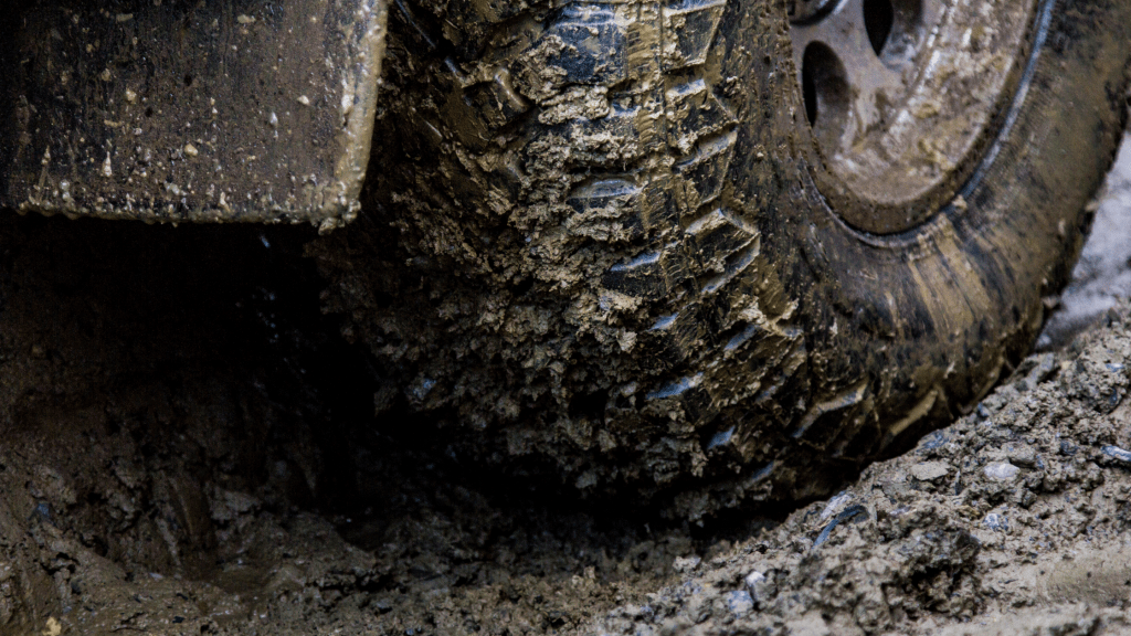
One way to explore them is by Overlanding; a self-reliant overland travels to remote locations, using proper off-road vehicles (from dirt bikes to trucks) to navigate the terrains.
These vehicles must accommodate necessary equipment, including food, clothing, tent, mattress, tool kit, and other essentials.
This is because Overlanding is like a camping and off-roading trip combination, which focuses more on the journey than the destination.
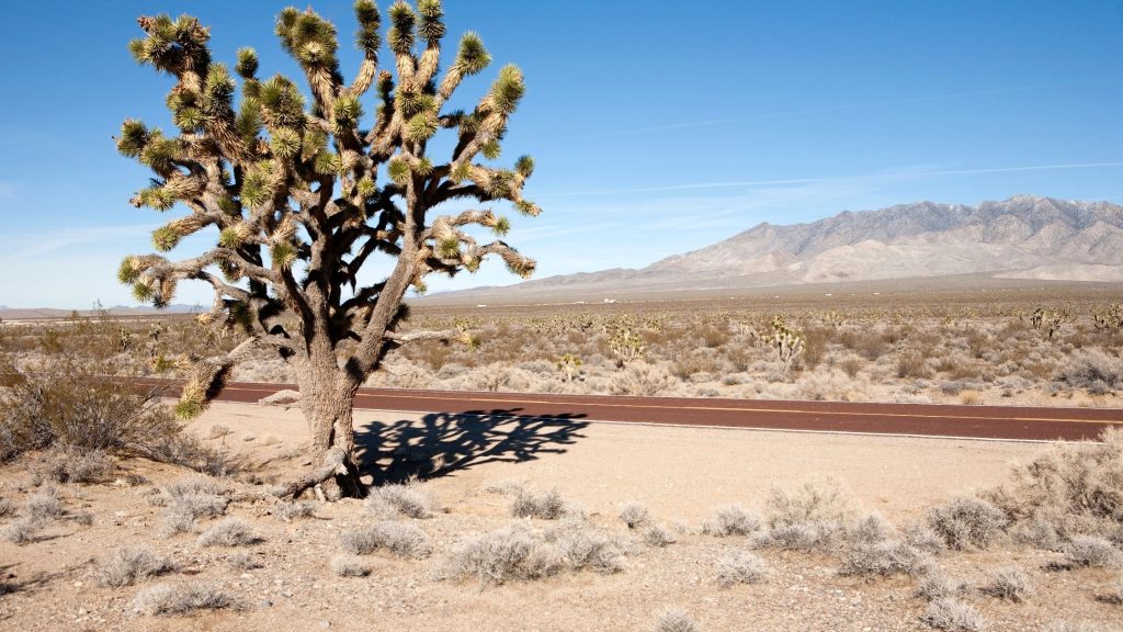
Overlanding has been in existence for centuries (majorly in Australia and South Africa) but not very common in the United States. However, it has gained popularity over the last couple of decades in the US and has been developed as a conventional sport and recreational culture.
North America has quite a good number of routes for Overlanders.
Overlanders have to be self-reliant and self-sufficient because the roads to such remote areas can be rough and near inaccessible. Although there’s usually low traffic —this makes the sport more appealing.
Here is a list of top Overlanding trails in the US; whether you are new to Overlanding or are a seasoned veteran looking for new paths to explore, this is for you:
- TRANSAMERICA TRAIL (TAT)
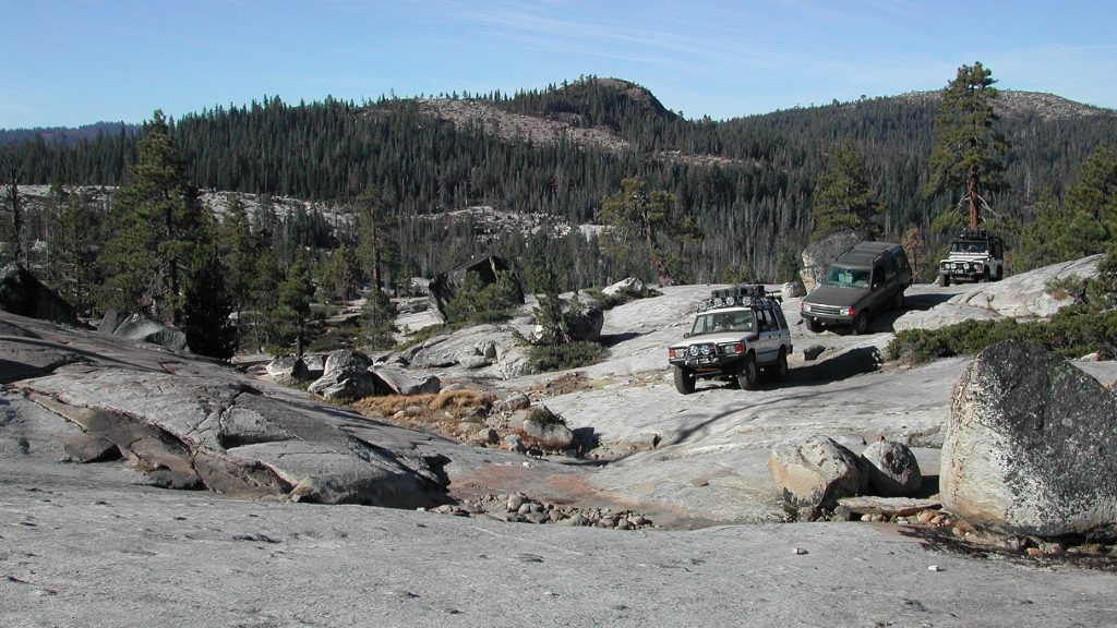
- RUBICON TRAIL, NORTH CALIFORNIA
- BLACK BEAR PASS, COLORADO
- THE GRAND ARIZONA TRAVERSE
- WHITE RIM ROAD, CANYONLANDS, UTAH
- SOUTH CORE BANKS, CAPE LOOKOUT NATIONAL SEASHORE, NORTH CAROLINA
- MOJAVE ROAD, MOJAVE NATIONAL PRESERVE, CALIFORNIA
- THE DALTON HIGHWAY, ALASKA
TRANSAMERICA TRAIL (TAT)
Do you want to take a trip from the eastern side of the US to the western side? Try the TAT.
It is mostly utilized to cross the United States using a minimum of paved roads for leisure and is largely trailed by motorcycle riders. Others decide to travel with 4×4 vehicles and even touring bicycles.
This trail goes from Virginia to Oregon and is about 5000 miles (8,046.72 kilometers). It sounds like a long drive; well, it could be about a two to three weeks journey.
This route gives you lots of beautiful scenery ranging from desert to forest to mountains, plains, and other landscapes. It also leads you through some fantastic hubs of the country, such as the Great Sand Dunes National Park, Yellow Stone National Park, and more.
RUBICON TRAIL, NORTH CALIFORNIA
This trail is a legendary one. It has now been used for over a century. And I don’t think it’s such a coincidence that the great Jeep Wrangler “Rubicon” is named after it.
This daring trail is located in Northern California near Lake Tahoe. It is a 22-mile route that runs through the Sierra Nevada.
This begins off Highway 50 near Loon Lake and terminates on Lake Tahoe’s west side at Tahoma.
As opposed to the most rural trail, Rubicon can have relatively dense traffic. It is very rugged, rough, and rocky. A word of warning! This trail is considered the most dangerous path out there.
However, speaking of aesthetics, it’s pleasing. These exclusive features make it fun and very challenging; those that have gone down this road can testify.
With good driving and a vehicle with top-notch mod, it will take about five hours to complete.
Are you up for the challenge? Get your gears, and let’s go Rubicon!
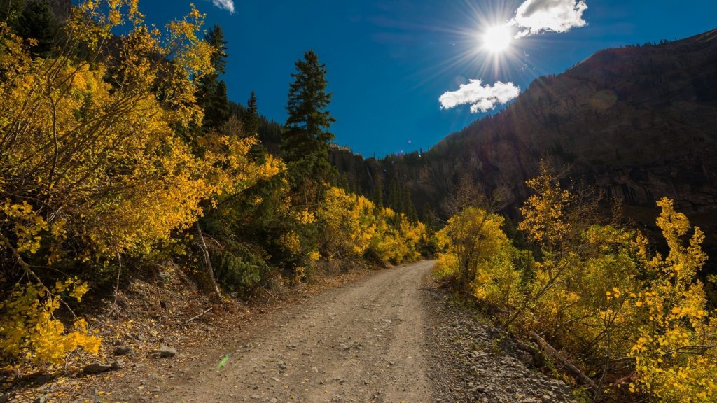
BLACK BEAR PASS, COLORADO
This trail is highly elevated and not an easy one. The Black Bear Pass, also known by its official name, Forest Service Road 648, is not a fragile mind’s route. It is an 8.5 mile rocky and mountainous route that passes from the Red Mountain Pass, US Highway 550 to Telluride, Colorado. There used to be a sign at the start of the train that reads:
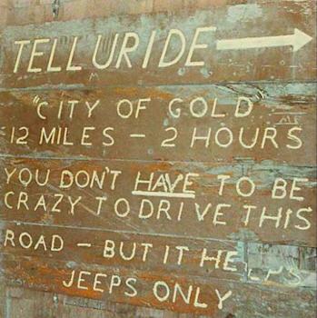
This gives you an idea of the level of experience needed to make it down this track. If you are scared of height, this trail is a no-no, as its highest elevation is 12,840 feet above sea level.
It has lots of switchbacks and sharp turns, making it very technical to navigate. As expected, the weather condition lends to the difficulty of moving through the route.
Right now, the road only opens for a few months in a year. It is usually accessible from late summer to early fall.
It gives beautiful scenes such as the Bridal Veil Falls (the highest waterfall in Colorado) and sparks excitement with a high altitude view.
Be careful! Don’t get carried away by the beauty of Black Bear Pass. Keep your eyes on the road.
THE GRAND ARIZONA TRAVERSE
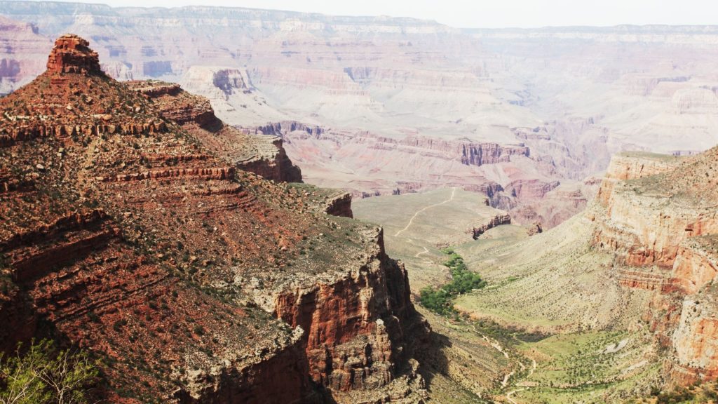
It shouldn’t be a surprising thing to find Arizona trails on this list. Arizona has the best routes for Off-roading and Overlanding.
The course spans 188 miles, starting from the town Dewey-Humboldt to the Grand Canyon. This route gives you an exciting ride with fascinating forest views, beautiful rocks formation, and exciting wildlife—the elevations on this track range from 3,800 feet to 7,500 feet.
Movement is relatively easy in good weather. But on rainy days, when the road will be muddy or during a heavy snowfall, it can be impassable. You’d best take a ride during summer or fall as the weather will be mild, leaving this route in good condition.
WHITE RIM ROAD, CANYONLANDS, UTAH
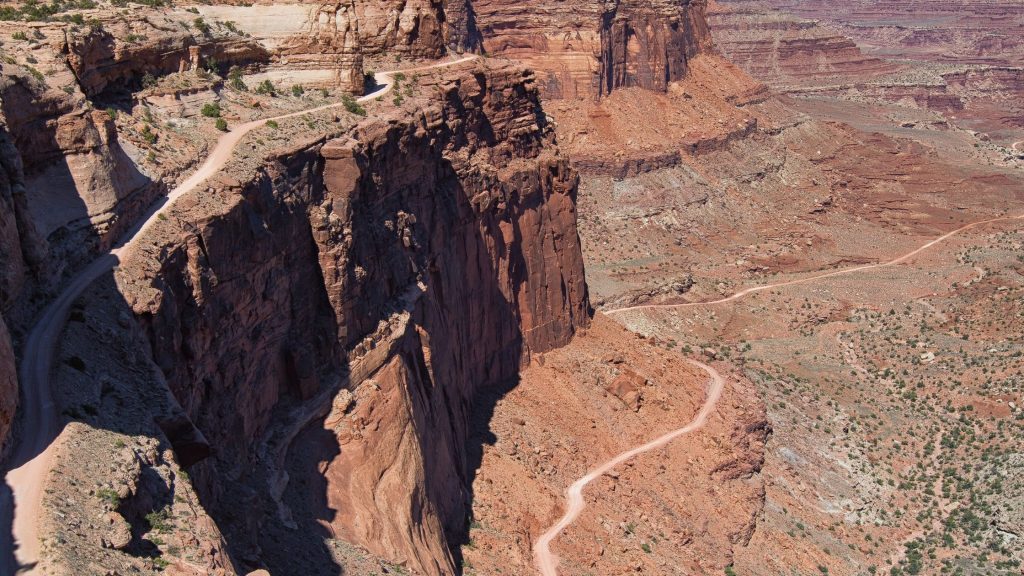
The White Rim Road is a 100-mile narrow dirt road that passes through the top of White Rim Sandstone, which is also below the mesa of the Canyonlands National Park, Utah.
It starts from Shaifer Trail, Potash Road, and ends at Mineral Bottom Road. Depending on your ride, it takes about two to three days to complete the journey down this route.
The vehicles that gain popularity on this track are mountain bikes and four-wheel drives. The reason for this is not far-fetched; the terrain of the road is quite rugged. This calls for low gearing, stellar rebound dampening, and other similar features in the vehicle traversing this road.
The steep grades and the absence of guardrails make to its medium difficulty. The surrounding rivers add to the beautiful scenery, sending chills of excitement through your nerves as you journey.
The experience is enriched by the numerous camping sites scattered along the route. However, this route can be affected by weather, just like the Black Bear Pass. Rain makes the road muddy and impassable.
Given the exciting course provided by this trail, you can imagine the population yearning for a trip. Now, there is a permit required to use the White Rim Road. And the licenses requested usually exceed its limit. It is advisable to make your reservations in advance.
SOUTH CORE BANKS, CAPE LOOKOUT NATIONAL SEASHORE, NORTH CAROLINA
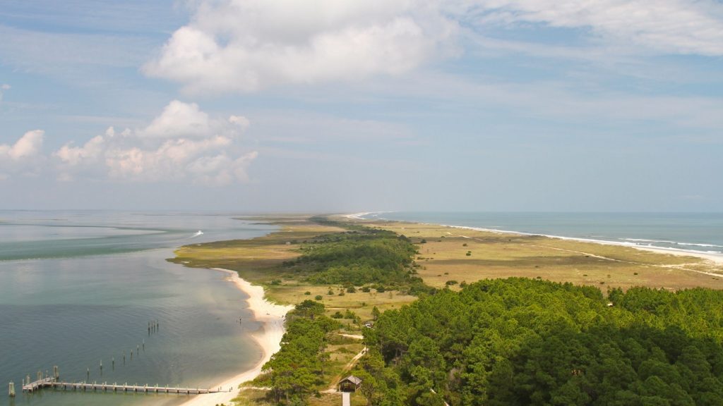
The Overlanding fun doesn’t have to start by driving. This route ensures that, as you have to go ‘over water’ before going ‘overland.’
It is situated on the South Core Banks’ island. Before hitting the road, you will have to take a ferry trip.
Here’s where the excitement begins. The 21-mile trail looks untouched and undeveloped and traverses from Ocracoke Inlet to the Beaufort Inlet.
Decorated with the Cape Lookout Lighthouse and Shackleford’s wild horses, the ride through this route leaves an exhilarating experience.
Be careful of the vehicle you take for this joy-ride. A four-wheel drive (especially with lowered tire pressure) is best for this road. Don’t get stuck in the sand!
Are you ready for a beach experience? Head for the South Core Banks.
MOJAVE ROAD, MOJAVE NATIONAL PRESERVE, CALIFORNIA
The Mojave Road, which is also known as Old Government Road, is quite a historical one. The trail is about 147 miles and takes overlanders 2-3 days to complete the drive.
The road has never been paved, making it look almost like it was right from time.
It spans from Beale’s crossing (a western bank river crossing site of the Colorado River) to the Fork of the Road, along the Mojave River.
With the terrain, a 4×4 truck is recommended. And it is one road you don’t want to journey on when it rains. Generally, the road is not technical.
However, it is believed among overlanders that there are areas where people have difficulties.
The fun is also heightened by the sight of multiple landmarks such as the Colorado River, Beaver Lake, the cattle ranches at the Lanfair Valley, the Indian Hill, Willow wash, and many others.
THE DALTON HIGHWAY, ALASKA
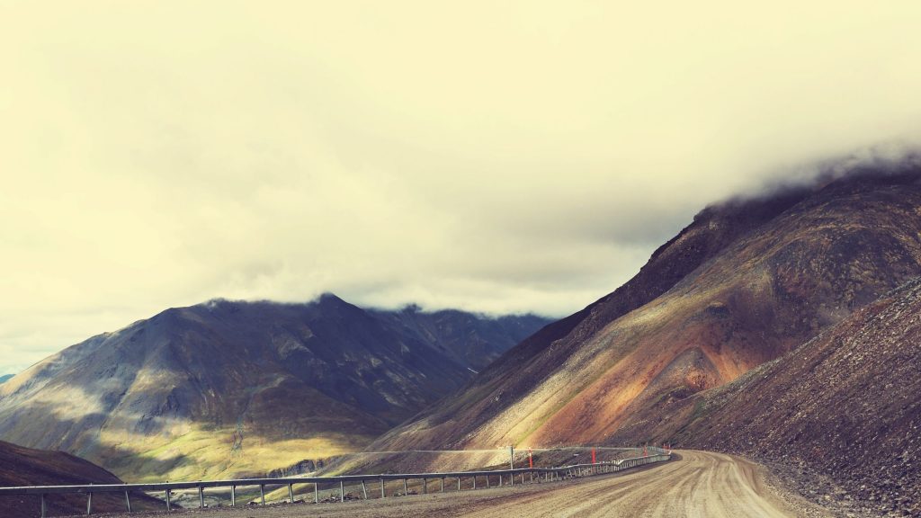
The 414-mile Alaskan trail is quite an old one that has been since the ’70s.
It starts at Elliot Highways and ends at Deadhorse, a settlement near the Arctic Ocean. Although there are three towns along this road (Cold foot, Wiseman, and Deadhorse), it possesses a beautiful landscape, making it aesthetically pleasing.
Even though it is an isolated road, it carries a significant amount of traffic, especially trucks. It is a very technical road that is not for the faint of heart.
Characterized by steep grades, the danger of blizzards, and avalanche. It doesn’t provide much infrastructure, including Medical centers and gas stations. Some parts are also filled with rough gravel and ice.
Nevertheless, Overlanders usually enjoy its beautiful features such as the Hess Creek, the sight of Yukon River, Graylin Lake, Galbraith lake, and many others.
Do you think you’ve got what it takes? Get on this Alaskan trail!
Here you are! You can push beyond your current limit of Overlanding experience by trying out these routes.

- Tips and tricks For Setting Up Camp Like a Pro - September 11, 2023
- The Best Multi-Tools for Overlanding Adventures - August 25, 2023
- Off-Road Navigation Tips for Overlanders - August 13, 2023